Sunday 28th October 2018
As usual got up at 4am and left home at 4.20 to drive the 325 miles to Cornwall, helped a little by the clocks going back an hour giving me an extra hour in bed. The drive took about five hours and I reckon that each trip is now going to knock about twenty minutes off the driving time.
I first drove to the Hell’s Mouth Café to check out whether or not there was a phone signal there for my possible need to call a taxi from there at the end of the day. Surprisingly, given its remote position, there was a signal so I drove on to the Garrack Hotel in St Ives (GR508406).

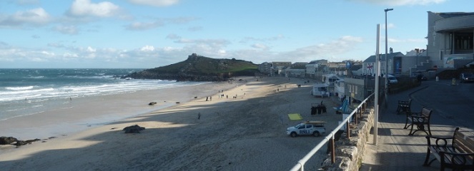
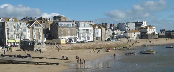
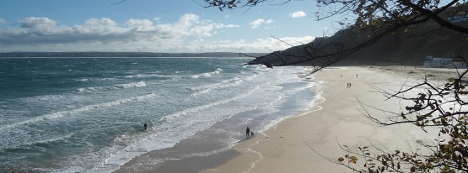
Walked down the hotel road and turned left down towards the sea on a day that was quite cold, about 7 or 8 degrees, windy, but sunny. Passed the Barnoon Cemetery to reach Porthmeor Beach (GR515408) where there were actually quite a few people about, even on the beach, although it was quite a cold October day.

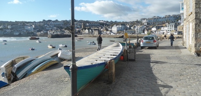
Passed the Tate Gallery and instead of going out on St Ives Head turned right to reach the harbour.
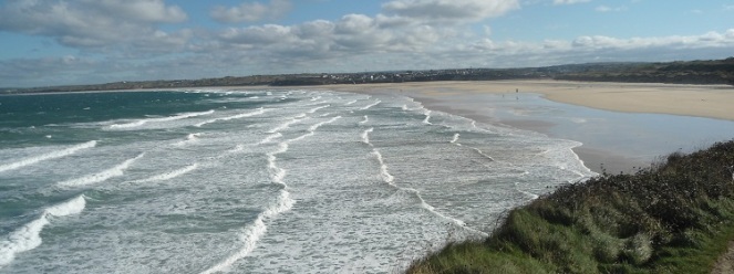
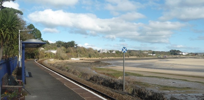
Followed the harbour wall and then onto a small promenade past the lifeboat station and a small lane leading to Porthminster Beach (GR520403).
A wide asphalt path went along the back of Porthminster Beach with the railway to the right raised up on a viaduct.
Towards the end of the path climbed up to cross the railway to continue on up to Porthminster Point (GR525398). There were good views ahead from here all the way around St Ives Bay to Godrevy Point which is close to the end of today’s walk.

Descended a little here to walk with the railway on the left and Carbis Bay appearing. The valiant attempts by people to enjoy themselves on the beach in a truly British fashion (waterproofs etc) had about finished by here.

The track climbed up above the railway (which seemed like an almost permanent recurring feature on the first half of today’s walk) past a couple of big new houses being built to join a lane. Turned left to pass by large houses on either side. Quite a lot of people out walking here, presumably from Carbis Bay. Took a footpath left off towards Carbis Bay.
Crossed the railway again by a steel footbridge (GR526389) and dropped down to the bay walking in front of the Carbis Bay Hotel. The road climbed steeply up to Carbis Bay station (GR529388). Just opposite the station entrance took a footpath off to the left. The path went down steps almost to the beach and inevitable goes up further steps but from that point on it was quite a slow descent.
Reached the point at Carrack Gladden (GR535389) which had good views back to St Ives and forward again across St Ives Bay. It would probably have been better to have gone along the beach as the path climbed steeply up steps to reach the railway again (GR535386) and then down the other side again of course. Continually going up and down steps above the beach actually became quite tiring on what should have been a very easy part of the South West Coast Path. Also the path was enclosed by hedges on both sides all the way so more would have been seen from the beach.
Reached the sand dunes at Porth Kidney Sands where the path is part of St Michael’s Way which according to the signpost is also part of the Pilgrim’s Way to Santiago. (The Camino de Santiago has various routes through Spain, Portugal, France and other countries finishing at Santiago de Compostela. St Michael’s Way from here to St Michael’s Mount on the south coast of Cornwall was intended as an alternative to sailing round Land’s End for Welsh and Irish pilgrims. The Camino is very much a tourist route today and one list of Seven Deadly Sins is: 1. Poor prior physical preparation. 2. Not listening to the body. 3. Carrying too heavy a load. 4. Walking to an imposed deadline. 5. Walking to another’s pace. 6. Following the crowd. 7. Stepping out from the present moment (i.e. getting lost). Good advice for many South West Coast Path walkers).

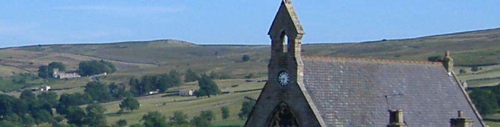
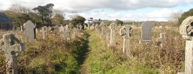
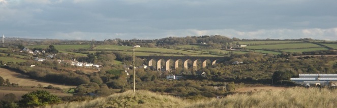
At the end of the dunes the path dropped down towards the beach. Turned right here and climbed up steps underneath the railway (GR549379) and continued up over the golf course to reach Lelant Church (GR548377). The churchyard which is Uny Graveyard looks overgrown as it has purposely been left to overgrow for wildlife (at least that is the excuse on the noticeboard).
Reached the road soon after the church and went forward about 50 yards and then took a slightly hidden turn left down a small lane to Lelant Station (GR548372) where the station house is now a private house. Stopped at Lelant Station and had a bit of a rest and something to eat.
Continued past the station on The Saltings which I guess has come from previous activity on the estuary. The modern houses along here were very attractive as was the whole area. As the road turned right took a footpath to the left and then right on the next road. This is an area of new but attractive houses that are somewhat less grand than the earlier ones. Reach the main road and turned left to cross the railway yet again, this time going underneath it. This is near Lelant Saltings Station (GR543366) which is a park and ride station for St Ives with quite a few people waiting for trains which seem quite frequent seeing as it is a Sunday in October.

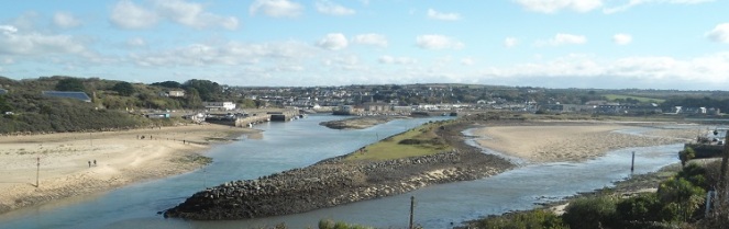
Passed The Old Quay House pub to reach the main road and The Causeway across the estuary (GR543364). The Causeway was very windy with quite a few birds sitting out on the estuary and a couple of small birds of prey (kestrels I think), one of which hovered about 5 feet above me before diving into the grassy verge – I was of course too slow to get my camera out. Followed the very busy and noisy main road into Hayle itself and just past Asda turned left underneath the railway only to cross back underneath again a few yards later to continue past Hayle Station (GR559373). Passed a memorial to Cyril Richard ‘Rick’ Rescorla who died in the 911 World Trade Centre attack and originally came from Hayle and was apparently directing the evacuation when he got killed (a man who led a highly varied life – read about him on Wikipedia). Close to this was a model beam engine celebrating Hayle’s history of building beam engines for the tin mines. It was of interest to me as we have an 1850 Watt Beam Engine at Loughborough University.
Had a drink in the Royal Standard Inn (GR558376) and then crossed the river by the old bridge to walk down the estuary. Walked along a new promenade where there are some fish-related business on one side, large new business park at the end, a café and a dock (GR553379).

At the end climbed up on to the sand dunes, through a large car park and took a path off to the right which led up over the dunes in front of some holiday chalets. Went past the Bluff Inn (GR554385) and then left on a footpath down towards the beach. Reached the beach at Cove Café, Hayle Towans by Black Cliff (GR554388).
Set off down an endless beach with strong headwinds of 25-30 miles per hour. With soft sand in places it became extremely tiring so decided to come off. The problem was that this resulted in an even more tiring climb up the soft sand of the dunes to eventually reach a wide stone track that serves the campsites around here. Decided to follow it out to the main road (GR574387) as an alternative route to Gwithian.
Reached the road and turned left. At least there was a footpath to start with but it eventually ended so had to climb the hill dodging the cars whose drivers were blinded by the low early evening sun. Tried to take a footpath to avoid the road but all it did was lead me round a vegetable field and back out again (GR583401).
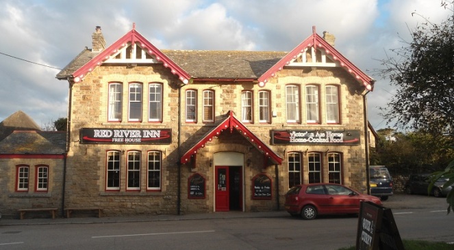
Carefully picked my way along the road to Red River Inn at Gwithian (GR586411). A friendly ‘proper’ pub and the landlady was kind enough to call me a taxi back to St Ives.
Days from Chepstow 169
Miles today 12.9
Miles from Chepstow 2073.8

A beautiful stretch of coast. And I think Lelant station is one of the prettiest I’ve come across.
LikeLike
Yes it is. I always read your posts many times over before each of my trips as part of preparations and certain photographs like your Lelant Station one stick in my mind and I seek out the location. The Motor Cycling Club gate at Trevellas Porth is another – I sat in front of this resting for 10 minutes before I noticed it. I could hardly walk down this track never mind ride a motor bike up it.
I’m loking forward to you resuming your Scottish posts,
Keith
LikeLiked by 1 person