Tuesday 23rd August 2022
We got a taxi from the Waterloo Hotel in Newport to Caldicot railway station (GR475876). The weather was much better today as we set off on the asphalt cycling track, long and straight, running quite close to the motorway. Our first task was to yet again cross a motorway (the M4 in this case). It seems that since Bridgwater in Somerset, eleven walking days ago, we have been intertwined with motorways (M4, M5 and M48), crossing them about ten times, walking very close on several occasions and walking on the footpath alongside while crossing the Severn Road Bridge. After about a mile on the cycle path turned left and crossed over the M4 at Rogiet Moor (GR462872).
The M4 Motorway with Prince of Wales Bridge in background (GR462872)
This should be the last brush with motorways before the final time in Port Talbot which is about 75 miles away along the coast path. Just over the motorway bridge we turned right along a very straight track across Caldicot Moor. Neither Caldicot nor Rogiet Moors had any resemblance to what I would recognise as moorland as they were very flat farmland without any trace of heather. At a track junction (GR459867) turned left down towards the estuary on an asphalt road that eventually became a gravel track.
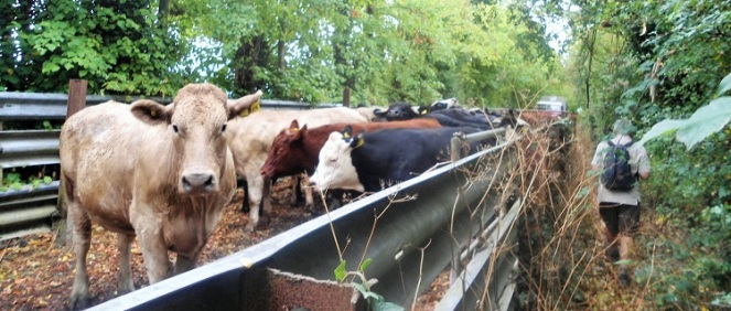
A cattle pen had been built halfway down the track almost completely blocking access and cattle were being driven into it from the surrounding fields.
Cattle on track across Caldicot Moor (GR459863)
After the entertainment of watching cowboy antics (using an all-terrain vehicle rather than a horse) we made our way past the penned cattle and eventually the track reached the estuary at Roggiet Moor Reen (GR461861). Another example of optional spelling – this time of Rogiet/Roggiet. The tide was obviously out as the only water visible was a long way away, but Avonmouth could be seen on the opposite bank. The Ordnance Survey map names this stretch of water as the “Mouth of the Severn” so we are yet to reach the Bristol Channel.
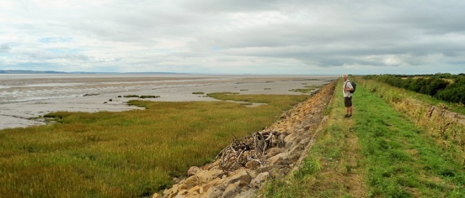
The embankment alongside Roggiet Moor Reen (GR460861)
We turned right on the long straight embankment with few notable landmarks until we reached Chapel Farm at Pennycloud (GR444853) by which time we figured out that we were probably opposite Portishead.
The vast openness of the Bristol Channel near Cold Harbour Pill (GR4278541)
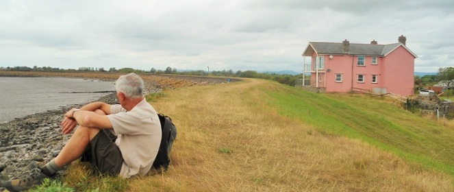
The embankment seemed to go on for mile after mile but with good walking underfoot and big views across the estuary. It was actually five miles to Elm Tree Farm at Gold Cliff and Porton House (GR389826) with its distinctive pink paint job was the only notable place. The village of Redwick, about halfway along the embankment and half a mile inland was a possible attraction with its pub but because of the layout of the footpaths it would have been a diversion of a mile or more.
Porton House in splendid isolation (GR539826)
With little to look at we could concentrate on our usual conversations on matters such as the outstanding intellectual and social characteristics of our previous university colleagues and our gratitude to the university for sending us on courses about diversity, unconscious bias etc. Having exhausted these topics the issue of the name of this blog arose. My original title of Walking around England was considered far too naff and lacking in cleverness by my children and so it was demoted to a strap line to the main title of Albion Ambulations. Having strayed into Wales the suitability of the title was questioned. Some alternatives from the commercial world sprang to mind like reducing it to its initials (such as with BA and BT for example) but AA had perhaps inappropriate associations with motoring and drinking. Another modern trend is to remove capitalisation and vowels such as Aberdeen Finance renaming itself as abrdn. albn ambltns initally looked suitably Welsh with its unpronounceable strings of consonants but then Welsh names also have strings of vowels. Looking for inspiration I discovered that whereas I had always thought that Albion referred to England in phrases like Perfidious Albion it actually refers to the whole of Great Britain so no need to change at all except for the strap line including Wales.
It was with some relief that we left the embankments of the coast at Gold Cliff (GR375821) and took the road up to the right where miraculously there was a small café cum shop where we sat and had a couple of wonderful cups of tea and cake. A short way up the road from the café we turned left on footpaths across the fields to a footpath running alongside Mireland Pill Reen to reach a road just outside the village of Goldcliff (GR370830). Here we found sanctuary in the Farmer’s Arms from where we called a taxi after a couple of beers.
The Farmers Arms, Goldcliff (GR365831)
That evening we decided to find an Italian restaurant in Newport. The first we tried to book was open but had no pasta (reminiscent of the Indian restaurant in Watchet with no food). We eventually went to Vittorio’s which was an excellent genuine family-run Italian restaurant.
Days from Chepstow 213
Miles today 9.6
Miles from Chepstow 2458.6


Wow you were brave. Not only did you sit in front of that pink house by the sea wall you (or someone with you) stopped to take a photo. Perhaps it has changed owners now? I remember when I walked this way it had a very aggressively worded sign at their boundary on the footpath something like “PRIVATE PROPERTY. No photos. No picnics, No stopping, No Cycling etc etc” (even though No photos is certainly not anything they have the right to demand).
LikeLike
I’ve seen this sign on Ruth Livingstone’s blog but I don’t think it is there now. The house has been owned by the same people since 2004 and I like to think that they were made to remove the sign as part of designating The Wales Coast Path as a National Trail. In any case there is no way that the sea defences (the embankment) are privately owned so the sign had no authority.
LikeLike